The Trans Cuenca 6 days Direct Tour is a magnificent exploration of the province of Cuenca.
Unlike the normal 6-day version, the long stage from Cañete to Cuenca (73 km) has been removed in favour of a much more reasonable stage (Cañada del Hoyo – Uña, 63 km) without passing through Cuenca city. In fact, the itinerary also ignores the Ventano del Diablo.
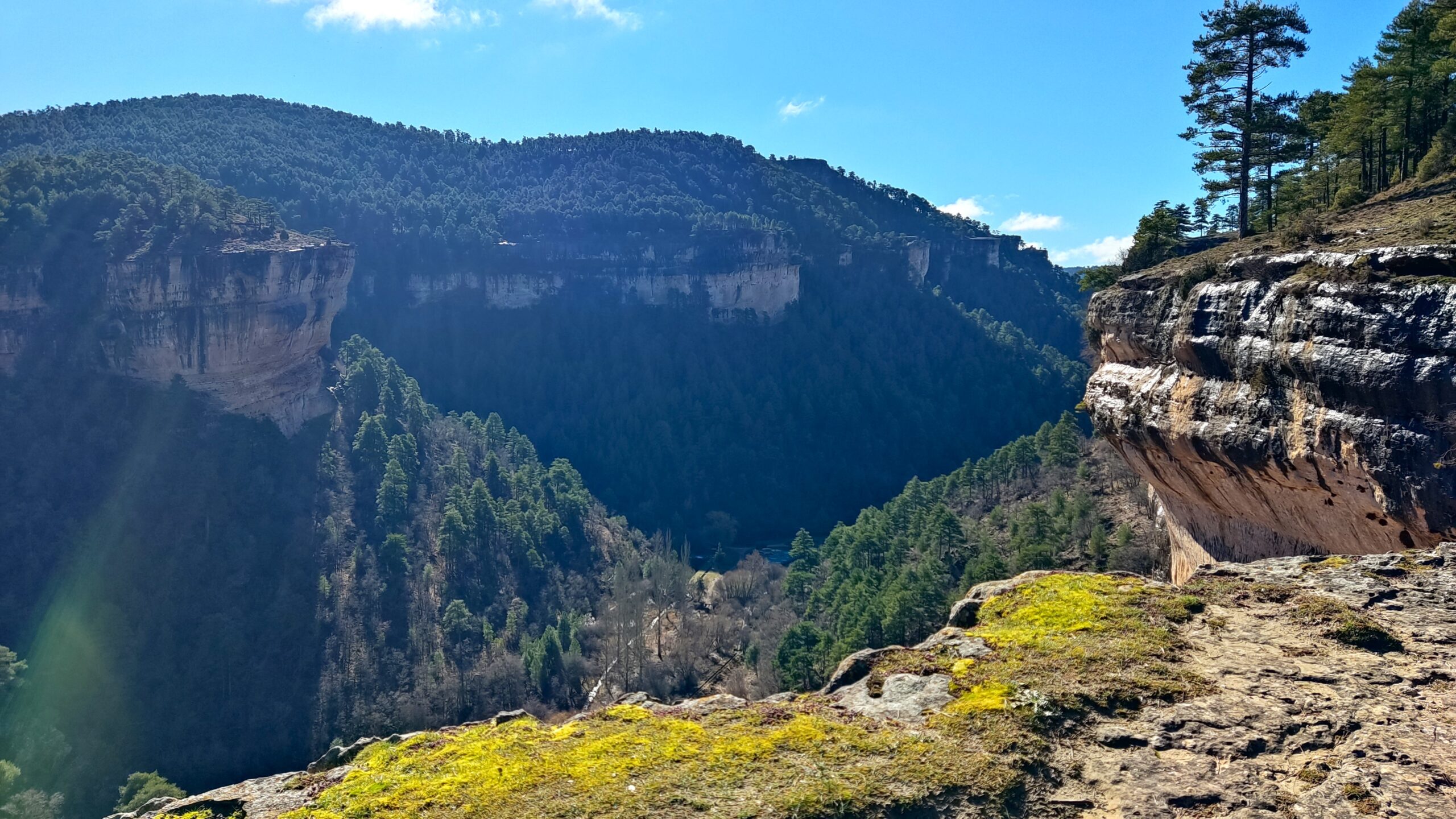
Thus, starting from Cañada del Hoyo, the circular route passes by the main attractions of the area. Thus, you ride through a large number of places of interest: from the Lagunas de las Cañadas del Hoyo to the Callejones de la Majadas; or from the spectacular Nacimiento del Río Cuervo to las Torcas or the wonderful Uña reservoir. In a context of the Serranía de Cuenca, full of deer, fallow deer, you will discover a landscape of impressive forests, enormous forests. The route will not disappoint you.
With luggage transport provided by the organization, comfortable accommodation, tasting local cuisine (such as Ajo Arriero, Zarajos, fresh Mojete or the powerful Morteruelo), this proposal will NOT disappoint you.
Así, Trans Cuenca. Entonces, Cuenca Btt. Luego, Cuenca by MTB. Finalmente, Cuenca MTB Route.
Day 1. Cañada del Hoyo.
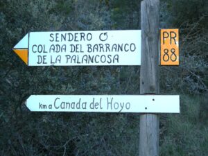
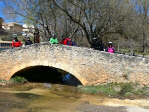
Arrival in La Cañada del Hoyo. Accommodation in a beautiful establishment, in the centre of the town, very comfortable. Dinner included (here, Morteruelo it’s a excellent dish). If there is time, a quick visit to the Castle is recommended. You can do the route on foot along the Roman Road and the Roman Bridge.
Además, Cuenca Btt. Luego, Cuenca by MTB. Entonces, Cuenca MTB Route. Por tanto, Trans Cuenca.
Day 2. Cañada del Hoyo – Uña.
62,99 km 1.375 m accumulated elevation gain
After breakfast, we leave Cañada in a northwesterly direction.
Thus, after crossing a beautiful forest with several characteristic pines to enter Las Torcas de los Palancares. A group of 24 more sinkholes or torcas, all duly referenced and catalogued. It is a curious natural phenomenon that occurs in calcareous soils (calcium carbonate) due to karstic erosion that dissolves it with the chemical reaction of rainwater, based on thousands of years. Another of the great attractions of Cuenca! There are very large sinkholes, there are tiny ones… How beautiful is the Trans Cuenca 6 Days Direct Tour!.
The route ascends, alternating all kinds of roads, also paved, up to 1,325 meters to reach Buenache de la Sierra, a small town with just over 100 inhabitants. However, the route does not enter the town, but instead, following a paved track, goes up to Collado de Nava to go down to Valdecabras. With barely 50 inhabitants, this town, currently a district of Cuenca, has good access by road. That is why it has some establishments where you can have a drink…
From there, there is a long stretch of road (unavoidable, it is the only option) that slowly ascends through the Serrania de Cuenca, to the Ciudad Encantada. A unique set of rocks and varied natural geological formations; outside of Cuenca city, the most visited tourist attraction in the province. The visit is 3 km long and its access (6€) is not included in the price. In addition, there is a good restaurant opposite…
 Afternoon
At the exit, there is a path towards the Uña viewpoint, where you can see the pretty village on the other side of the valley at the foot of a small lake. And there the route leads down paths and trails in the middle of a landscape of extensive pastures and huge forests… filled with roe deer, deer and fallow deer. It is another hunting reserve, as in almost all the forests in the area. Once agriculture has been abandoned, hunting is the main resource. Riding in silence, it is easy to see a deer, a roe deer… or even a small herd.
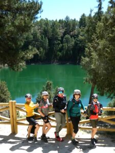
Finally, Uña. Accommodation in a rather peculiar establishment located right in front of the pretty lake. It should be said that this is a lake where the accumulation of trout is so high that they are often seen jumping. Dinner, included. End of the 2nd stage of the Trans Cuenca 6 Days Direct Tour!.
Así pues, Cuenca MTB. Finalmente Ruta MTB Cuenca. Entonces, Trans Cuenca. Por tanto, Cuenca Btt.
Día 3. Uña – Vega del Codorno.
55,30 km 1.350 m accumulated elevation gain + 2,3 km walking (Callejones de las Majadas) + 1.5 km walking (origin Rio Cuervo)
After breakfast, you have to leave Uña on a PR along a not very clickable path of almost 1 km that goes up through a beautiful forest. It takes 30 minutes to push the bike because the terrain is stony, although the slope is not excessive. But the effort is rewarded, the route goes up to the cliff along a beautiful path that goes around the lake of Uña. It is a magnificent ride, with several impressive viewpoints and even a stretch of wonderful forest… It really is worth it!
After 8 km the path leaves the beautiful cliff and goes up and down between oak and pine forests. After the Torrente de la Madera, the path becomes a wide track that soon reaches the Mirador del Tio Cogote, where a spectacular aqueduct can be seen. But the track continues towards Los Callejones de Las Majadas, for many, the replica (AND BETTER: quieter, less touristy and geologically more interesting) of the Enchanted City. It is a 3.5 km route that runs through a unique landscape between large blocks of stone and curious geological formations… A marvel! It is better not to do it on a bike (but on foot), because while enjoying the surroundings you cannot be aware of the terrain and it is easy to have an “incident”…
Afternoon
On leaving, the Trans Cuenca 6-day Direct Route takes you in the direction of Las Majadas (there are several bars and restaurants), but it does not go in, but rather goes into the “depth” of the Serranía de Cuenca. Thus, it crosses from south to north from Las Majadas to Rincón del Cuervo. In fact, the route goes around the Parque Cinegético Forestal del Hosquillo, considered the essence of the landscapes and geography of the Sierra de Cuenca. It is a CLOSED reserve with a great diversity of wild animals (from bones to foxes, roe deer, deer,…). Unfortunately, due to this park, the road from Las Majadas to Rincón del Cuervo has recently been paved.
Arriving at Rincón del Cuervo, the Trans Cuenca 6 Days Direct Tour takes a small stretch of road to enter the Nacimiento del Rio Cuervo. It should be said that it is the first of the 3 sources that appear in the vicinity of the Serranía de Cuenca. In this case, the Cuervo is a tributary of the Guadiela that feeds the Tajo. The route cannot be done on a bike (but it can be done with a bike) because a good part of the route is on wooden crossings… often wet. Whatever the case, it is a spectacular place, with several wetlands.
Now, there is only a short 3 km stretch left to the accommodation in Vega del Codorno, where you can enjoy a good dinner (included) in the same accommodation.
Finalmente MTB Cuenca Tour. Entonces, Trans Cuenca Btt. Por tanto, Cuenca Btt. Así pues, Cuenca MTB.
 Day 4. Vega del Codorno – Frías de Albarracín.
64,47 km 1.137 m accumulated elevation gain
This is the most mountainous stage of the Trans Cuenca 6 Days Direct Tour, entering the Montes Universales. And visiting the sources of the Tajo and Júcar, separated only by a ridge!!.
So, after breakfast, we head south along the Camino de las Acebeas towards Tragacete (we don’t go in, so as not to lengthen the route). The landscapes of this first one clearly recall the Catalan Pre-Pyrenees, between beautiful black pine forests, boxwoods and some specimens of holly… Finally, the Estrecho de Sant Blas, where the Júcar river is born. In fact, we can continue 2 km further, to the Estrecho del Infierno…
Returning to the Estrecho de San Blas, the route must go around the Sierra de Valdeminguete. You have to walk 9 km of good track on the southern side (where the waters lead to the Júcar that dies in the Mediterranean sea) to reach a small stretch of road and turn around, towards the northern side, where the waters go to the Tajo (Atlantic sea). The track back on the north side is very wide and was possibly opened to extract firewood because the surface has the appearance of compacted gravel…
Since there are no restaurants in the vicinity, you can have a small picnic at a crossroads of the Alto Tajo. In fact, in the “Normal” option you will be given a picnic bag in Vega del Codorno. In the “Assisted” option you will have a small meal…
Afternoon
On the bridge of the 3 provinces (Cuenca, Guadalajara and Teruel) you enter the Alto Tajo Natural Park, surrounded by a landscape of extensive pastures and wonderful forests. It is one of the most beautiful stretches of the entire route… and full of deer, roe deer and fallow deer…
When you reach the road, you have to follow the road for a few metres to find a beautiful path (signposted) that runs parallel to the Tajo River. It is an impressive stretch of almost 7 km, between extensive meadows, small groves, in a wonderful natural environment, which ends at the source of the Tajo River. The route has been leaving Cuenca behind and entering the province of Teruel (about 5 km). Be that as it may, Empty Spain in an exceptional corner, between wetlands, streams, in the Montes Universales.
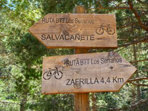
From here the route heads towards Frías de Albarracín, first along a very good track to the Collado del Navazo and, secondly, along a downhill road. In Frias de Albarracín you will find dinner (included) and accommodation. Enjoy a well-deserved rest on the Trans Cuenca 6 Days Direct Tour.
Entonces, Trans Cuenca Tour. Por tanto, Cuenca MTB. Así pues, Cuenca MTB Tour. Luego MTB Tour Cuenca.
Day 5. Frías de Albarracín – Cañete.
67,24 km 957 m accumulated elevation gain
A much easier stage, given that a good part of it is downhill! From the High Serranía, at more than 1,500 m. high, to the Lower Serranía, at just over 1,000 m. high, and with a great diversity of landscapes, in a stage with small villages…
After breakfast, the route leads to the first hole (or circular sinkhole) of the twenty that there are in the Trans Cuenca: the Sima de Frías de Albarracín. But to leave the asphalt, you follow an old road (totally destroyed) that joins the main road, to soon come out onto a good track. And link up with the GR 10.1, given that the route follows a good part of the GR del Tajo.
This is how you enter the Montes Universales, a landscape of large mountain ranges and extensive forests, which you do not cross transversely, but longitudinally. You roll easily through the large plains at the bottom of the valleys, with thick forests on the slopes. You just have to climb and cross the crest to leave one valley and enter the other. Like in the Loma Rasa, which when you go over it, you return to Cuenca (leaving Teruel) and to the waters of the Júcar (Mediterranean). A stretch of barren land and numerous junipers that surprises among the large, green pastures at the bottom of the valley.
Thus, the route, generally downhill, of more than 18 km, runs through a good part of the Serranía de Cuenca, to Zafrilla, entering through the Roman Bridge.
Zafrilla is an example of empty Spain. This small town of 53 inhabitants (in 106 km2, that is, 2 inhabitants per Km2), had almost 1,000 inhabitants and 4 population centres in the 1970s.
Afternoon
The landscape continues to change, descending in altitude, reaching Salinas del Manzano, 20 km away. Located in the “Serranía Baja”, the Romans already exploited the Natural Salt Mines. And this is another case similar to Zafrilla: historically it was important but currently it only has 73 inhabitants, half of whom are over 60 years old. Empty Spain.
There are still 10 km to Cañete. You continue along the bottom of the valley, on the other side of the Henarubia river, through a much more Mediterranean landscape of the Serranía Baja, with peaks of less than 1,300 metres…
Cañete surprises, because it still preserves a good part of the walls, the enormous castle and some of the city’s portals. Originating during the Bronze Age, it was one of the most important in the area (you only have to see the walls and remains of the castle). Cañete has its charm and is well preserved. In 1940 it had more than 1,800 inhabitants. Now there are less than 800; in 80 years it has lost more than 1,000… Also, the large number of sculptures in memory of the locals is surprising; women cleaning clothes by the river (by the way, near a beautiful waterfall), the Holy Week procession,…
The accommodation in Cañete is magnificent, in a good Hostal Restaurante. There you can dine (included) on typical local dishes.
Además, Trans Cuenca. Por tanto, Cuenca Btt. Así pues, Cuenca en MTB. Finalmente Ruta MTB Cuenca.
 Day 6. Cañete – Cañada del Hoyo
40,88 km 687 m accumulated elevation gain.
It starts with the steepest climb of the entire route (passing through where there was an Iberian settlement), but it is already the last day and it is still cool at first light…
The descent is made along a fairly broken track. In the whole of the Transcuenca you will not find any path with drainage! At the bottom of the valley, the route joins a stream, making it uncyclable. For this reason, you leave the main track and go up to the top of a hill (a goat pasture area) that goes down to Pajaroncillo. Barely 60 inhabitants and it looks like a very, very “old” town.
From there, continue towards Pajarón, which at the beginning of the 20th century had more than 400 inhabitants and now there are about 70… In fact, in a desolate landscape of the Lower Serranía of Cuenca, on a fairly barren land, Pajarón was the centre of an important battle in the 13th century between the Castilian troops and the Catalan-Aragonese (victors) in the period when the “limits” of both kingdoms were established. The tower of the imposing castle can still be seen.
But the route continues westwards, towards Cuenca through the Lower Serranía towards a great tourist attraction: the Natural Monument of Las Lagunas de Cañada del Hoyo. A group of approximately 15 circular chasms, of which 7 are filled with rainwater. Some are private and not always open to visitors. The route visits 3 or 4… highly recommended, such as the Laguna de la Gitana.
From there, the route goes down 3 km to Cañada del Hoyo. There, where you spent the first night, you will find your luggage. How beautiful is the Trans Cuenca 6 Days Direct Tour.
END OF TOUR
Además, Trans Cuenca MTB. Por tanto, Cuenca Btt Tour. Así pues, Cuenca MTB Tour. Finalmente Ruta MTB Cuenca. Luego Cuenca MTB Tour. How beautiful is the Trans Cuenca 6 Days Direct Tour.a.
INCLUDES:
- 6 Half-board accommodations (except for Cuenca accommodation, first day; bed and breakfast).
- Lunch at midday on stage Day 4. Vega del Codorno – Frías de Albarracín, with Picnic Bag (since there is no place to eat along the entire route).
- Luggage transportation, from accommodation to accommodation, ending in Cuenca.
- Tracks (in TRK and GPX format) and maps of the route.
- Seguro obligatorio.
Así pues, Cuenca MTB Tour. Finalmente, Route MTB Cuenca. Además, Trans Cuenca Tour Por tanto, Cuenca Btt Tour.
 NOT INCLUDED
- Last day accommodation in Cuenca (optional, with a supplement).
- Snacks, shots, liquors, various drinks and other extras not included in the establishments’ menus.
- Cancellation insurance (optional, with a supplement).
- Tickets for visits and other activities.
- Everything not detailed in the INCLUDES section.
Además, Trans Cuenca MTB. Por tanto, Cuenca Btt Tour. Así pues, Cuenca MTB Tour. Finalmente Ruta MTB Cuenca. Luego Cuenca MTB Tour. How beautiful is the Trans Cuenca 6 Days Direct Tour.a.
